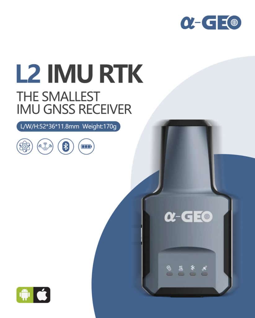
Alpha Geo L2
The Smallest Geodetic GNSS Receiver in the World
Key Features
- Small and lightweight design
- High performance
- Fast initialization
- Calibration-free IMU
- Compatibility with a variety of GNSS software platforms
L2 GNSS Receiver
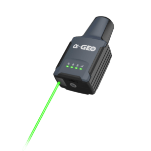
The L2 is a lightweight and compact GNSS receiver with an IMU, making it ideal for a variety of surveying and mapping applications. It is the smallest geodesic GNSS device in the world so far, weighing less than 170g.
Despite its size, the L2 is fully equipped with all necessary components, including a high-performance OEM board and 1408 channels. This allows it to support all satellites and frequency bands, ensuring exceptional performance even in complex environments.
The L2 also features a fast-initialization, calibration-free IMU module that is immune to magnetic interference. This enables users to collect or stakeout topo points up to 60 degrees without requiring additional calibration.
The L2 communicates with your NTRIP client or GNSS software (eg SurPro) via bluetooth. At Augview we recommend use of the open source Lefebure NTRIP client to provide a ‘mock GPS’ feed of corrected coordinates. Currently only Android operating systems are supported.
Applications
The L2 is a versatile and powerful GNSS receiver suitable for a wide range of industries, including:
- Land surveying
- GIS industry
- Pipeline measurement
- Construction
- Agriculture
- Mining
- Forestry
Please fill our our quote form below, or email Mike@augview.net
Specifications
| Model | |
|---|---|
| L2 | |
| GNSS Performance | |
| Satellites Tracking | GPS: L1 C/A, L2C, L2P, L5 GLONASS: L1C/A, L1P, L2 C/A, L2P BEIDOU: B1, B2, B3, B1C, B2a, B2b GALILEO: E1, E5a, E5b SBAS: WAAS, EGNOS, MSAS, GAGAN, SDCM IRNSS: L5 QZSS: L1, L2C, L5 |
| Channels | 1408 |
| Cold Start | < 30 seconds |
| Hot Start | < 3 seconds |
| RTK Signal Initialization | < 10 seconds |
| Initialization Reliability | > 99.9% |
| Speed | 0.03m/s |
| Update Rate | 1Hz – 20Hz |
| RTK Performance | |
| RTK | H: 8 mm + 1 ppm V: 15 mm + 1 ppm |
| Code Differential | H: 0.25 m + 1 ppm V: 0.5 m + 1 ppm |
| SBAS | H: 0.3 m V: 0.6 m |
| Correction Data | CMR, CMR+, RTCM2, RTCM3, RTCM32 |
| Data Output | NMEA Outputs |
| Power Supply | |
| Battery | Rechargeable Internal 1800mAh lithium-ion battery Support USB Type-C fast charging |
| Voltage | 5V |
| Working Time | 10h |
| System | |
| Bluetooth | Fully integrated Bluetooth V4.0 |
| Data Interface | Type-C |
| Tilt Compensation | Fast initialization, dynamic tilt survey up to 60° |
| Physical | |
| Dimension | 118 mm x 52 mm x 36mm |
| Weight | 170g |
| Operating Temperature | -20℃ ~ +75℃ |
| Storage Temperature | -40℃ ~ +85℃ |
| Water/Dust Proof | IP67 dust proof, protected from 30min immersion to depth of 1m |
| Shock | Survive a 2m pole drop onto concrete |
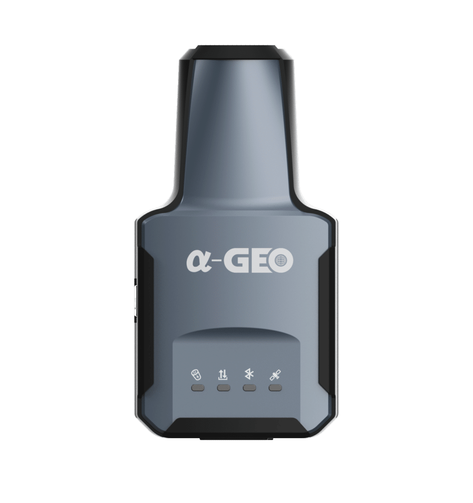
| Indicators | Satellites, datalink, battery, Bluetooth |
| Button | Power Key |
Request a Quote
For further questions on the Alpha Geo l2 please fill out the form below: